Hai Ou from the Sky
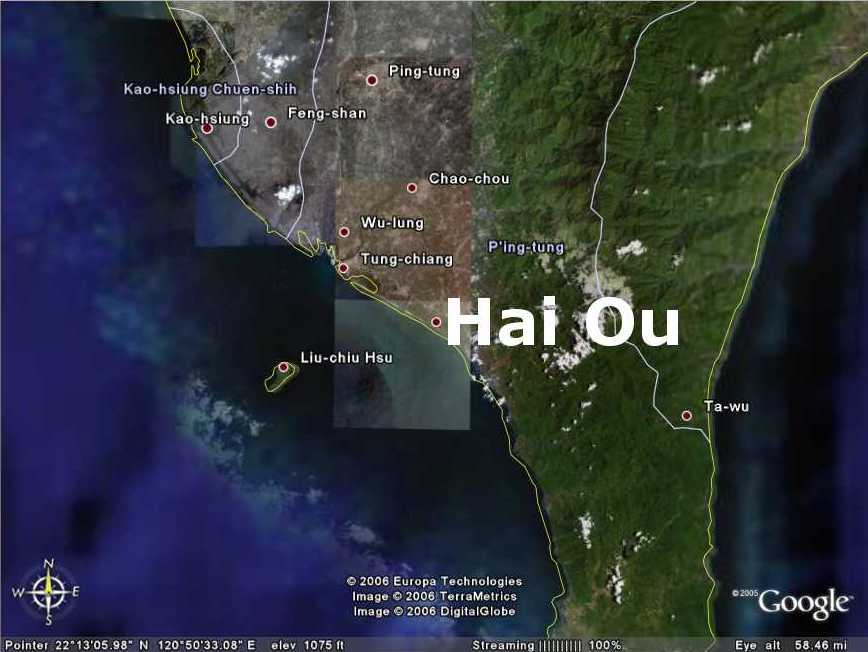
Dad called this past weekend to point out that Google Earth finally updated their satellite photos of Taiwan and he found Hai Ou! Here's where it's actually located on the southern end of the island. I added the name and red dot in Paint Shop Pro (don't bother searching for it in Google Earth yourself):

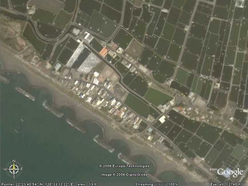
Here's the closeup:
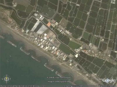
The town hasn't changed at all in 27 years as far as I can tell. Still microscopic and still only two major streets, one on each side of the fish ponds in the middle. The majority of buildings are built between the main street and sea wall on the SW end. The other major street is on the NE end and those are mostly shops. One of those buildings on the NE street is where my pre school used to be.
The only real difference I can tell is in the little half-moon shaped formations on the beach. Looks like little, artificial bays to break up the waves. So much for taking a trip back there to get salt water up my nose by the waves crashing over me!
You can even see the seagull statue in the far Eastern corner of the village. It's just a white line running almost directly North to South and you'd probably have to zoom in within Google Earth itself to make it out right. You can sort of see the figure of the statue in the shadow it casts, though.
In the southernmost edge of the village is where the new ICA building was built. Just NW of it is a building with a blue roof that first housed my pre school before we moved across the ponds to the street with the shops. Just SW of there (up the hill of the seawall) is a restaurant where Mom, Dad and I would have the occasional dinner consisting of 100 Shue Jiao (Jiao Tze). Boiled pork and vegetable dumplings, basically.
So, for all those out there wondering just where this little village was on the island, now you have your answer.
Here's the closeup:
The town hasn't changed at all in 27 years as far as I can tell. Still microscopic and still only two major streets, one on each side of the fish ponds in the middle. The majority of buildings are built between the main street and sea wall on the SW end. The other major street is on the NE end and those are mostly shops. One of those buildings on the NE street is where my pre school used to be.
The only real difference I can tell is in the little half-moon shaped formations on the beach. Looks like little, artificial bays to break up the waves. So much for taking a trip back there to get salt water up my nose by the waves crashing over me!
You can even see the seagull statue in the far Eastern corner of the village. It's just a white line running almost directly North to South and you'd probably have to zoom in within Google Earth itself to make it out right. You can sort of see the figure of the statue in the shadow it casts, though.
In the southernmost edge of the village is where the new ICA building was built. Just NW of it is a building with a blue roof that first housed my pre school before we moved across the ponds to the street with the shops. Just SW of there (up the hill of the seawall) is a restaurant where Mom, Dad and I would have the occasional dinner consisting of 100 Shue Jiao (Jiao Tze). Boiled pork and vegetable dumplings, basically.
So, for all those out there wondering just where this little village was on the island, now you have your answer.
posted by Chris Druckenmiller at 7:02 AM
![]()


0 Comments:
Post a Comment
<< Home